Our
21 mile, 3-day backpacking trip in Pt. Reyes Each of these photos can
enlarged by clicking on them. |
|
|
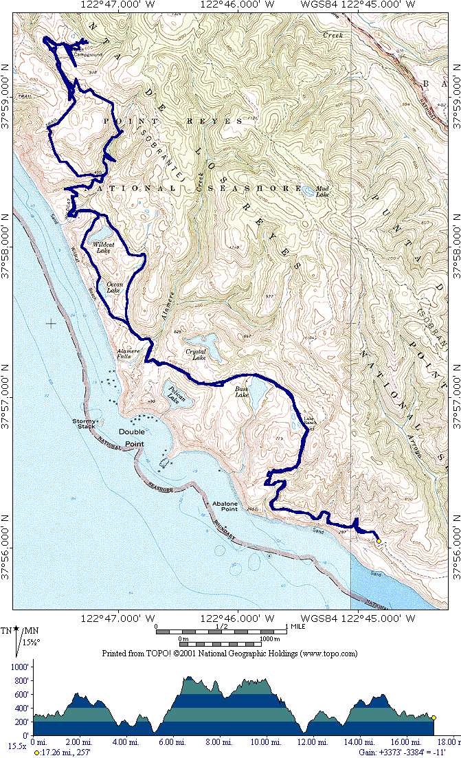
This is a map of the Point Reyes area just North of San Francisco. The blue line is the path of our hike as recorded by my Garmin III+ GPS. We began our hike at the Palomarin trailhead just outside of Bolinas. We traveled NW along the coast, climbing inland, curved around Bass Lake, then heading toward the coast as we passed Pelican Lake. Continuing along the coast we arrived at Wildcat camp. The 2nd day we hiked the counterclockwise loop (top of map) to visit the Glen camp area. And on the 3rd day, we returned to Palomarin trailhead taking the inland path. Below the map is the elevation profile showing the steep climb to the Glen camp and the length of our path (omitting the 4 mile beach hikes) as 17 miles. |
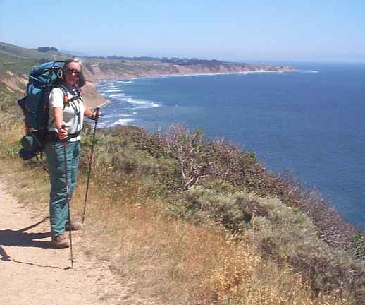 |
About 2 miles from our starting point, we had this magnificent view of the Pacific coast. |
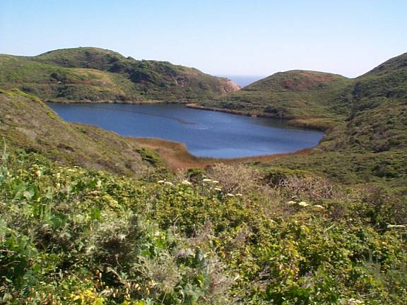 |
Along the way to Wildcat camp we passed Pelican Lake. It's probably named that because there were a few dozen pelicans flying in and out. The ocean is just over the hill. |
 |
We arrived at Wildcat campground around 4 p.m. and set up our camp site. Then we walked barefoot along the beach. About one mile south is Alamere falls, one of the few falls that drop directly to the ocean's beach. Notice the beautiful rainbow. |
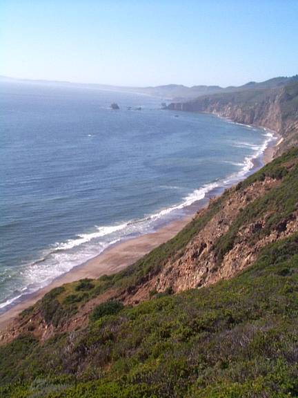 |
About 1/4 mile from our camp site on the bluff is the beach which offers a panoramic view of the coast. |
 |
As dusk approached, we watched the sun silently sink into the ocean at 8:03 p.m. while sipping on a hot cup of soup. |
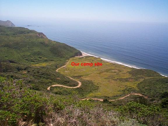 |
Rather tired from a full day of hiking, we were lulled to sleep by the soft roar of the ocean. The next morning after a warm breakfast we started our hike to check out the Glen campsites. After a steep climb, we had this view of our campsite. |
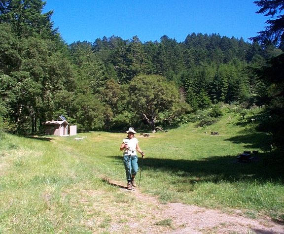 |
A little over 5 miles later, we arrived at Glen campsite. We were the only ones there. Ray took a sponge bath, washed his clothes, and then we took a short nap. After checking out the camp sites, we headed back to camp. |
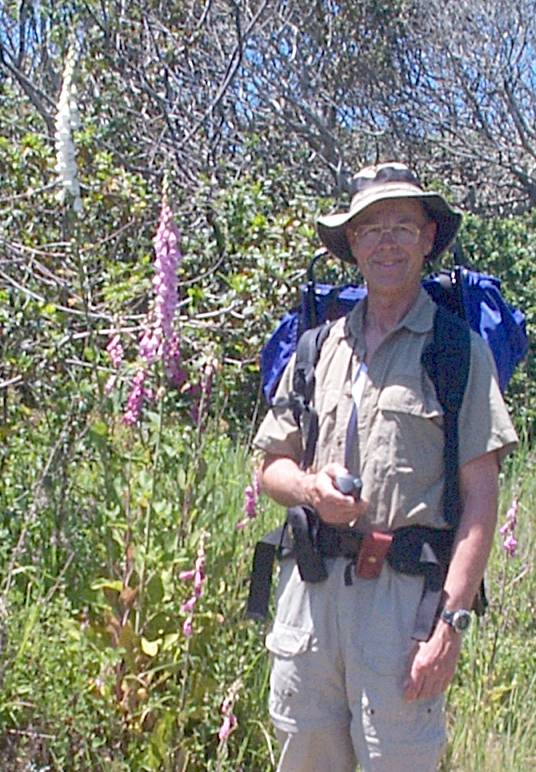 |
Along the way back from Glen camp, we saw many wild flowers. These are foxglove. |
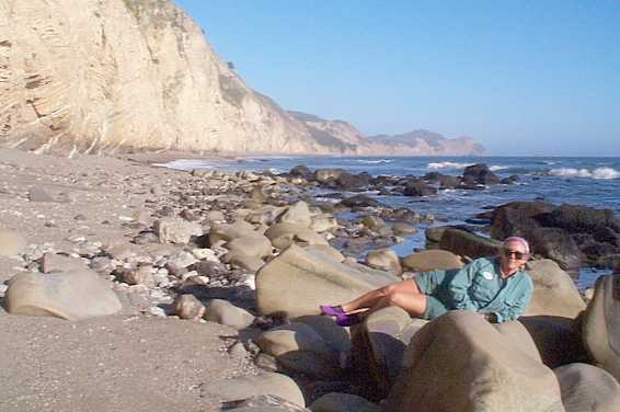 |
Back at our camp at Wildcat, we decided to explore the northern beach as far as we could walk. Fortunately, the tide was out so we were able to walk a little more than a mile. At the end it got rather rocky in spots. The beaches are very clean as few people are willing to hike this far. |
 |
The third day, when we got up we found that we'd had a visitor who left his "calling card" on the table next to us. The day before we had a fox walk through camp and later that evening an elk popped his head up about 30 feet from Betty. Then we saw about 6 elk grazing within 100 yards of our camp. The camp site has running water, pit toilets, and food storage lockers. We broke camp, put on our 40# backpacks and headed home. The end of a perfect 3-day trip. |