Six days in Death Valley and surrounding areas Each of these photos can
enlarged by clicking on them. |
|
 |
We planned to spend 11 days on this vacation. We were going to visit a kennel and perhaps purchase a dog, then travel around Death Valley. Betty had a contingency plan to visit other places in the area. On our return, if we purchased the dog, we'd pick him up on our return home. Instead we went home after 6 days because the dog purchase decision was delayed and the winds were too strong to make tent camping fun. See map to left and read on for details... |
|
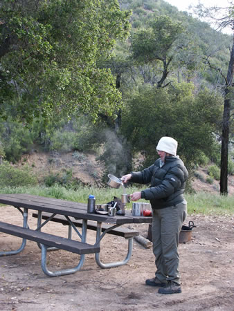
We spent our first night at the
Navajo campground about 20 miles East of San Luis Obispo. This is a
small camp area at 2,290 foot elevation 4 miles off highway 58. At
night it dropped to 32 degrees.
A cup of hot chocolate was welcome to take the chill off.
|
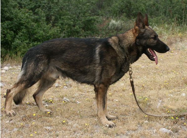 |
That morning we drove about 120 miles to a breeder in Santa Clarita to look at a German Shepherd. We loved the dog but the owner had second thoughts about selling him so we'll have to wait for her decision. This was a big disappointment as we'd tailored our trip around seeing this dog and if he was a match, we'd planned to bring him home on our return. |
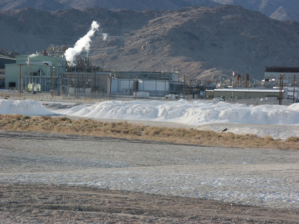 |
We left the kennel and drove another 240 miles, stopping at the town of Trona. This photo is of the Westend plant on the South side of Searles Lake. It was organized in 1920 and produces lime, soda ash, borax, and sodium sulfate. |
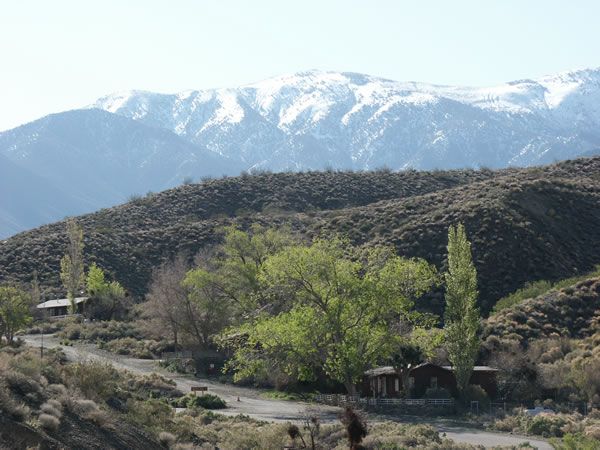 |
For our second night, we camped at the Wildrose campsite which is in the Panamint Range on the West side of Death Valley. Elevation was 4,100 feet. In the foreground is the Ranger's station with the snow on the distant mountains. That night the temperature dropped to 31 degrees. |
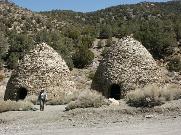 |
The next morning we drove to the two campsites beyond Wildrose; Thorndike and Mahogany Flat at the end of the road. Between them were these huge limestone kilns used to make charcoal. Ten were built in 1879 and only used for 3 years. |
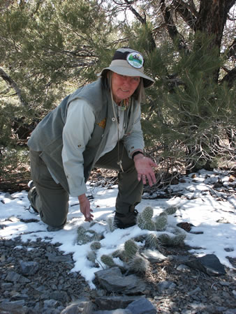 |
The roads to Mahogany Flat
recommends 4-wheel drive and reasonable ground clearance. We crossed
muddy stretches and areas with snow on the road. At Mahogany
Flat, elevation is 9,092 feet. Interestingly enough, we found cactus
living in the snow.
These are nice campsites with picnic tables and some shade from the Pinyon pine trees. But with snow on the ground, we preferred to stay in the sun. |
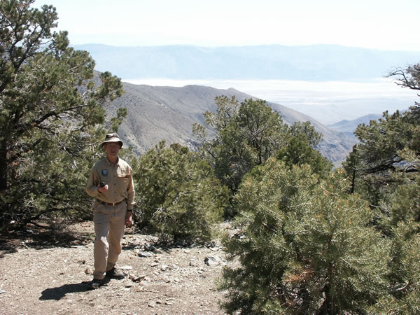 |
Looking out at Death Valley from Mahogany Flat. For those who want a good hike, there's a trail upward to Telescope Peak which is at 11,049 feet. However, they caution hikers about slipping on the ice. |
 |
We then drove back down the mountain into the floor of Death Valley. We traveled to Stovepipe Wells Village, roughly in the middle, then took a 3-mile side road South to Mosaic Canyon. Rain in the perimeter mountains causes huge torrents to gouge canyons through the rock. We hiked about 1/2 mile up this beautiful spot - all the while wondering how many people have been caught in a surprise flash flood with no why out! |
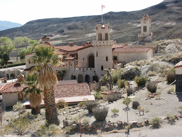 |
Continuing about 45 miles, we visited Scotty's Castle at the Northern end of the valley. This is a mini Hearst Castle that was never completed and is now operated by the National Park Service. There's plenty of water here - and begging coyotes. |
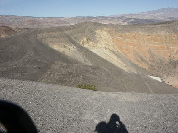 |
We started to drive 27 miles off-road to see the RaceTrack - an area where rocks creep across the desert. But the washboard road was unbelievable - we couldn't go over 5 miles per hour without shaking the 4Runner apart. So we turned back and visited the Ubehebe Crater. This is what happens when molten lava meets water-soaked bedrock - boom - and you instantly have a half-mile wide and 770 foot deep crater. |
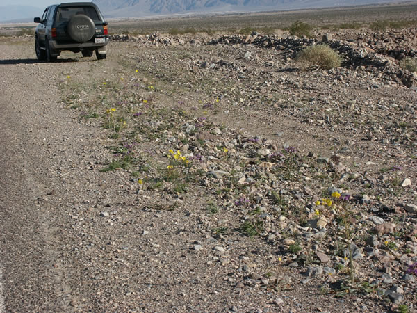  |
Oh, and you've heard of the
fabulous floral display in the spring when the desert in is bloom?
As the desert is tough on plants, I guess we should marvel that anything grows. Here's a "good" shot of the "flower-covered" highway. These flowers are typical - small and struggling. |
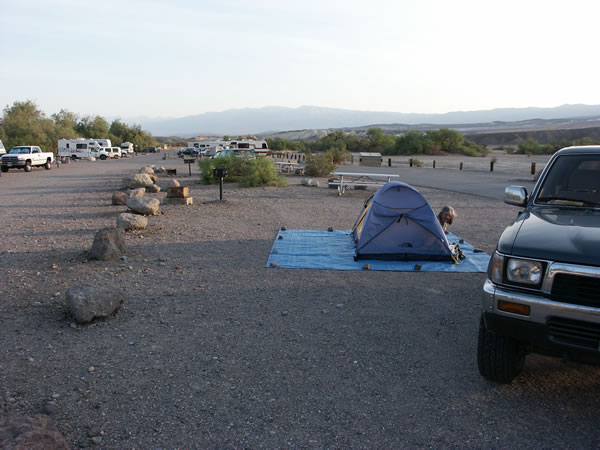 |
After a long day of driving, it's about 90 degrees outside, we planned to stay at a nearby campground, Stovepipe, only to find out that the National Park Service closed them the day before. So we drove 25 miles back to Furnace Creek campground just in time to get this choice spot - near the sewage dump station. Notice the rocks holding down the tarp. This became standard practice as it was windy everywhere we stayed. In the valley, it's never very cold. The lowest it got was 68 during the night as the elevation is 190 feet below sea level. |
| Click here to continue... | |